The Famous Thorny Path: Amazing Sailing and Powerful Trade Winds
Part 4: Culebra to St. Martin & a Recap of 47 Days Along the Thorny Path
We are continuing our travels east along the Thorny Path. In our last article, we sailed along the south coast of Puerto Rico and made our way to Culebra. We had a blast there, and it was cool to see our next stop of St. Thomas on the horizon.
In Part 4 of this Thorny Path series, we travel from Culebra to St. Martin. We start this leg of the journey by motor sailing approximately 20 nautical miles to the US Virgin Islands, arriving in St. Thomas. We spent some time with friends in St. Thomas exploring the island, and spent a few days checking out St. John. We then got an incredible weather window for an overnight sail to St. Martin.
I will also recap in this article our entire Thorny Path experience, from Great Exuma Island, Bahamas all the way to St. Martin. The Thorny Path was full of new challenges, pleasant surprises, and more.
Culebra to St. Thomas
We were so excited for a short day sail and arrival to the U.S. Virgin Islands. We had mild wind conditions of 4 to 5 knots out of the east southeast, with minimal swells and waves around 1-3 feet. These conditions are few and far between, and following the guidance in Passages South by Bruce Van Sant, we took this weather opportunity to continue our travels east along the Thorny Path.

We had heard great things about the Brewer’s Bay anchorage in St. Thomas while watching Sailaway’s videos on YouTube, so we set our sights to anchor here.
Note:
As Americans, when traveling from Puerto Rico to the US Virgin Islands, you do not need to check-in.
There are “Boaty Balls” (mooring balls) in this anchorage that are first-come, first-serve for $35 a night, or you can anchor in Brewer’s Bay. We decided to anchor, and our anchor held very well and didn’t get caught on any rocks when we pulled her up.
There are a ton of sea turtles in this anchorage, and we loved being able to swim at the beach and off the back of the boat here.
Brewer’s Bay is located immediately adjacent to the airport’s runway. The planes taking off and landing at the airport was also fun to watch.

Brewer’s Bay Anchorage
- Latitude: 18° 20’ 29.94”N, Longitude: 64° 58’ 46.67”W
- Holding: Good holding in sand/coral bottom
- Wind Protection: Protected from north through southeast winds with no/minimal swell
- Depth: 25-30 feet
- Pet Friendly: Yes, there is a beach here, and sidewalks for great dog walks
- Groceries: No, but you can take a safari bus from here for $1-2 per person to get to several different grocery stores
- Restaurants: There are a couple of food trucks at the beach, no restaurants that are walking distance
Exploring the United States Virgin Islands
While is St. Thomas, we knew we wanted to do a few chores, such as filling propane, getting some gas and diesel for our engines, and pick up a few fresh groceries and a few spare parts for the engines.
After we spent a few nights in Brewer’s Bay, we moved over to the Water Island West anchorage, located directly across from Crown Bay Marina.
This anchorage is full of boats on private mooring balls, but there is still room to anchor in this area.
Nonetheless, we had plenty of room to anchor, and were situated in a good spot for a quick dinghy ride for propane, gas and diesel from Crown Bay Marina, and use of Crown Bay Marina’s dinghy dock for shore access to the grocery store, and auto parts store.


Water Island West Anchorage
- Latitude: 18° 19’ 42.44”N, Longitude: 64° 56’ 57.96”W
- Holding: Good holding in soft sandy bottom
- Wind Protection: Protected from all directions except southwest with no/minimal swell
- Depth: 20-30 feet
- Pet Friendly: Yes, there are great dog walking areas at Crown Bay Marina from their dinghy dock
- Groceries: Yes, there is a Pueblo’s grocery store a short walk from the marina
- Restaurants: Yes
After getting our boat chores completed, we moved anchorages again to Charlotte Amalie Harbor to check out the downtown area.
There are two dinghy docks in this harbor, one is located at Yacht Haven Grande Marina, and the other is located along the seawall behind the US Coast Guard’s pier.
The dinghy dock at Yacht Haven Grande Marina had great grassy areas for dog walks. It was also a short walk away to Pueblo’s grocery store (a bit bigger and more organized that the Pueblo’s near Crown Bay Marina), Kmart (Yes, Kmart still exist!), and The Washboard Laundromat (the most efficient laundromat we’ve come across to date).
The dinghy dock near the US Coast Guard’s pier lands you right in the downtown area near all sorts of shops and restaurants. We ended up here on a Sunday with no cruise ships in town (and happened to be St. Patty’s Day!).
The town was shut down, and we had the pleasure of walking through the quiet streets and hillside to check things out. And we found a bar open full of locals celebrating the good Irish holiday!
We also learned how to use the Safari bus system. It’s the local bus system with open-air trucks that run routes throughout the island. Depending on how far you need to go, the cost is either $1 or $2 per person.
We asked around and learned where the “bus stops” were and took the Safari bus from Charlotte Amalie to Red Hook for $2/per person each way to find some items at Budget Marine.
While we loved the access to everything in Charlotte Amalie anchorage, it was a VERY rolly anchorage. It was so rolly, we left early to head back to Brewer’s Bay.


Charlotte Amalie Anchorage
- Latitude: 18° 20’ 09.45”N, Longitude: 64° 55’ 43.56”W
- Holding: Good holding in soft sandy bottom
- Wind Protection: Protected from all directions except southeast with A LOT of swells in the anchorage
- Depth: 20-30 feet
- Pet Friendly: Yes, there are great dog walking areas at Yacht Haven Grande Marina from their dinghy dock.
- Groceries: Yes, Pueblo’s near the Yacht Haven Grande dinghy dock, and Moe’s Fresh Market not too far from the dinghy dock downtown
- Restaurants: Yes, several from both dinghy docks
In hindsight, we learned where the Safari “bus stop” is located near the Brewer’s Bay anchorage, and would have moved back to Brewer’s Bay sooner for our errands to Red Hook. There is always a learning curve when it’s your first time to a new place!
We wanted to check out the famous Pizza Pi, so our next stop was Christmas Cove Anchorage on the east side of Great Saint James Island. While not the cheapest pizza you will find, it was absolutely delicious, and a lot of fun floating around with fellow cruisers and visitors.
We also got in some great snorkeling at Christmas Cove, seeing lots of coral, reef fish, and even a very curious squid that we hung out with for several minutes!


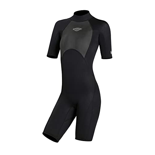
Men's, Women's, Diving Scuba Surfing Suits, One Piece Short Sleeve Thermal Wetsuits Back Zip Swimsuit for Snorkeling Kayaking Water Sports (M, 2MM Women Black)

Christmas Cove Anchorage
- Latitude: 18° 18’ 45.17”N, Longitude: 64° 49’ 58.05”W
- Holding: Good holding in sandy bottom. We anchored here, but there are also several free mooring balls to tie off to if they are available
- Wind Protection: Protected from northeast to southeast with minor swells in the anchorage
- Depth: 25-30 feet
- Pet Friendly: Yes, there is a small, slightly rocky beach that I paddle boarded to with Mangaux for our morning walks
- Groceries: No
- Restaurants: Yes, Pizza Pi! Definitely worth a stop!
While hanging out in St. Thomas, our friends dropped us a line and said they were on their way to visit us! Looking forward to some time with friends, and maybe some air conditioning, we got a slip for Pelagia at American Yacht Harbor, and enjoyed spending time with them on the north side of the island.
Our friends rented a place near Magen’s Bay, with views of both the bay and the Caribbean Sea. While hanging out with them, we checked out the beach at Magen’s Bay. It’s absolutely beautiful with clear water and white sand. We can’t wait to anchor here with Pelagia and spend more time here in future visits.
We also adventured our way up to Mountain Top to check out the incredible views of the Virgin Islands and British Virgin Islands. There is also a massive gift shop, up here with world-famous banana daiquiris. The views are a must see and have been rated as one of the world’s top ten views by National Geographic.


American Yacht Harbor Marina
- Latitude: 18° 19’ 31.55”N, Longitude: 64° 51’ 03.95”W
- Cost: $3.15/foot/day; Arrival time is 2:00 PM, may be able to arrive earlier, if slip available, at a charge of $55; Check-out time is 12:00 PM, Departure time is 1:00 PM or charged $50 for every 30 minutes
- Slips: Fixed docks (no finger piers at the slip we were assigned)
- Power: $0.75/kwh
- Water: $0.23/gallon
- Laundry: No
- Bathrooms/Showers: Yes – they are very nice (once you find them)
- Pet Friendly: Yes – beware of several stray cats in the area
- Groceries: Yes – Moe’s Fresh Market across the street
- Restaurants: Yes – several in the area
My $0.02
-American Yacht Harbor did have availability for us at two days/short notice. There were not many other options available to us and we prefer the safety and security of the boat at a marina while we are away.
-They only provide one key card per boat so leaving the boat separately can be a challenge.
-There is a $10.50 additional charge per night for security/trash that they do not tell you about until after you confirm your reservation with your credit card. I did have concerns about security, as multiple times after checking in and getting our one card, we found the gates propped open.
After our fun and relaxing visit with our friends, we headed over to St. John. There were some unusual northwest winds coming our way, so we stayed on the south side of the island. We were able to get a ball in the Virgin Islands National Park at Great Lameshur Bay.
Great Lameshur Bay was a beautiful anchorage with a dinghy dock to access the beach at Little Lameshur Bay, and several hiking trails within the national park.
We completed a 5-mile round trip hike to the petroglyphs from Great Lameshur Bay. It was a moderately challenging hike with some fairly steep inclines but it was very neat to see the old petroglyphs near a fresh water pool and waterfall, which was unfortunately dry when we visited.


Color: Blue Heaven

Buy these for hashing through the bush, and hiking to waterfalls! They are super light and comfortable, I love mine!
Lightweight Joggers Pant for All Seasons Elastic Waist Deep Gray
We stayed at the Great Lameshur anchorage for 3 nights before taking advantage of the westerly wind to head east to St. Martin. We can’t wait to explore more of St. John on our next visit to the US Virgin Islands.
Great Lameshur Mooring Field
- Latitude: 18° 18’ 50.26”N, Longitude: 64° 43’ 20.46”W
- Cost: $26 per night; or $13 per night with Golden Card access (senior citizens, Veterans, etc.).
- Holding: Ball held well, with plenty of room between boats
- Wind Protection: Protected from northwest through southeast
- Depth: 15-30 feet
- Water: No, but good water to use your watermaker in
- Pump Out: No pump out
- Laundry: No
- Bathroom/Showers: No
- Pet Friendly: Yes, beaches and hiking trails (must be kept on a leash)
- Groceries: No
- Restaurants: No
St. John to St. Martin
With some northwesterly winds to help us along our last leg of the Thorny Path, we took this weather window to continue east 95 nautical miles to St. Martin.
This was our first opportunity, excluding a short 8 nautical mile sail from St. Thomas to St. John, to actually sail without motoring for a majority of the passage. It was great sailing conditions and we sailed into the night with several other boats taking this weather window to sail to St. Martin.
We arrived to St. Martin early the next morning, eager to explore and learn how to get around both St. Martin and St. Maarten.
While we waited for the 8:30 AM bridge opening, we hung around the Marigot Bay anchorage on the French side. We caught the 7:30 AM cruisers net on Channel 10, and they provided us with helpful local knowledge, and even some coordinates, for getting through the narrow, unmarked channel once inside the lagoon.

Recap Of The Thorny Path
We traversed the Thorny Path bit by bit, covering 953 nautical miles in 47 days in February and March.
We left out of Great Exuma Island, Bahamas, traveling through Dominican Republic, sailing across the Mona Passage to Puerto Rico, then US Virgin Islands, arriving in St. Martin. A recap of each segment of our journey can be found in these articles below:
Sailing To The Dominican Republic – The Thorny Path (Part 1)
Sailing In The Dominican Republic – The Thorny Path (Part 2)
Sailing Puerto Rico – Discover The Charms of the Southern Coast (The Thorny Path: Part 3)
We had no set timeframe to travel within, other than a goal of reaching Grenada by the beginning of hurricane season, that starts on June 1st.
After being held up by weather in West Palm Beach for 27 days before we could cross the Gulf Stream to the Bahamas, we took every weather window that came our way. We feel we are still in a good timeframe to make Grenada by the beginning of June.
Each section of the Thorny Path has it’s own challenges. As discussed in Passages South by Bruce Van Sant, traveling the north coast of Dominican Republic is best done at night taking advantage of the night lee. Traveling the south coast of Puerto Rico is best done in the early morning hours, in short hops along the coast.
Our most uncomfortable sail was when we went against the guidance of Bruce Van Sant and sailed overnight from Isla Caja de Muertos to Culebra, instead of doing short morning hops along this section of the coastline. The calmest winds we saw on this passage was the early morning hours as we were nearing Culebra!
Traveling to new places in the Dominican Republic and the west and south coast of Puerto Rico were all very pleasant surprises. I think it is important to travel with an open mind, and don’t let frustrations of learning new places and cultures set you back.
Would We Travel The Thorny Path Again?
Maybe someday, but not anytime soon. We look forward to exploring the eastern Caribbean for a few years(?) and having the opportunity to travel back to places within the Caribbean that we will have been, but would like to explore more of, all without beating into the easterly Trade Winds for 47 days straight!
What Would We Do Differently Along The Thorny Path?
Three things come to mind:
- We would stop in Luperon in the Dominican Republic. While we are glad that we got the opportunity to continue east to Puerto Plata, about 17 nautical miles east of Luperon, we’ve heard so many good things about Luperon, and the cruiser community there, that we would love to check it out.
- While in Samana Bay, we would make sure to fit a stop in at Los Haitises National Park. The pictures and reviews from people seem so incredible, that we would like to check it out for ourselves.
- We would not do an overnight sail along the south coast of Puerto Rico, but continue with the short morning day sails all along the coast, even if it will take us more time. The overnight sail from Isla Caja de Muertos to Culebra was more uncomfortable and rolly than any of the early morning day sails we completed along the south coast of Puerto Rico.
What Would We Do The Same?
For starters, we would continue to follow the guidance in Passages South by Bruce Van Sant. We referred to this book repeatedly throughout our travels along the Thorny Path.
We would continue to explore new stops along the way, but also revisit some of our favorite stops we found. Some, but not all, include:
- Samana, Dominican Republic
- Puerto Real, Puerto Rico
- La Parguera, Puerto Rico
- Culebra, Puerto Rico
Conclusion
I hope you enjoyed traveling the Thorny Path with us as we made our way from the Bahamas, through Dominican Republic, Puerto Rico, US Virgin Islands, and over to St. Martin. If you are considering sailing the Thorny Path, then I hope you find our experiences helpful as you prepare for your own adventures. We would love to hear about your favorite stops along the Thorny Path and share some sea stories!
Learn More Sailing Tips Here:
- PredictWind Review: Pros, Cons & Real Use at Sea
- 12 Essential Subscriptions Used When Boating as Full-Time Sailors
- Favorite Weather Apps For Sailing: Discover The Best Features
- Crossing The Gulf Stream: 4 Proven Tips From A Coast Guard Veteran
- Sail Route Planning: How To Have A Safe And Successful Passage With These 6 Key Elements
- Sailing at Night: Top 10 Tips in the Helpful Guide
- Sailing with a Dog: Practical Guide for Cruisers
- Sailing with a Dog in the Caribbean: Ruff Times?
- 10 Things to Know about Cooking on a Sailboat
Want to download our Pre-Departure Checklist?
Get the Pre-Departure Checklist before your next passage.
Take the stress out of your departures with this editable pre-departure checklist.

