Florida ICW by Sailboat: Stressful “Sailing” Under 65-Ft Bridges
Inside In The Florida ICW Or Outside In The Atlantic Ocean
After a wonderful summer in the Chesapeake where we hid from hurricanes this summer, we are on the move south. We had pleasant weather and wonderful passages from Solomons, MD in the Chesapeake Bay down to St. Augustine, FL.
We stayed on the Atlantic Intracoastal Waterway (ICW) for most of Virginia and North Carolina, and sailed in the Atlantic Ocean outside of South Carolina, Georgia, and northern Florida, just like we did when heading north in the spring.
We prefer to sail in the Atlantic Ocean compared to taking the Florida Intracoastal Waterway, or inland waterway, all the way to southern Florida. Sailing in the Atlantic and seeing the beautiful moon light up the sky on overnight passages is so peaceful. Much more relaxing that passing under the Florida ICW bridges with a 65-foot clearance with our 45-foot sailboat that has a 63-foot mast, plus lights and antenna on top of it! But sometimes, the weather and our schedule have other plans for us.
We just completed a stressful 90 nautical mile, 3-day trip from St. Augustine, FL to Titusville, FL going through the Florida ICW. We had a schedule to keep for the upcoming Thanksgiving holiday, and got delayed in St. Augustine for a week due to a significant weather event just off the coast of the United States.
Learn why we chose to go down the Florida ICW from St. Augustine to Titusville, passing through 16 bridges, nine of which are fixed bridges with a 65-foot clearance, and how we dealt with higher-than-normal tides with no online tidal gauges in these areas that we are aware of.
On A Schedule
Before I get into more detail about our trip through the ICW, it is worth mentioning that being on a schedule while sailing is never a good idea. Weather, boat repairs, and other unexpected issues can always come up (and they do!) that can delay you from getting to a specific location by a specific date.
In our case, we wanted to get to Titusville by November 21st for Scott’s dad to pick us up there so we can spend Thanksgiving with him. We had made marina reservations and I had scheduled a doctor’s appointment for the next day.
However, due to a low-pressure system that was spinning off Florida’s east coast for several days causing strong winds, we stayed in St. Augustine for a few extra days before continuing our trip south.
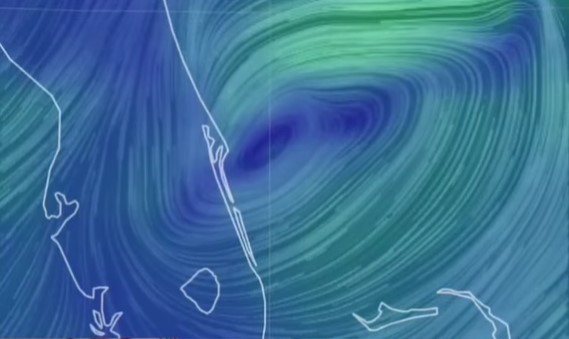
This low-pressure system also prevented us from sailing outside in the Atlantic Ocean as it was creating waves over 10 feet with gusts nearing 30 knots. This is outside of our comfort zone for safely sailing in the Atlantic, and it takes a couple of days for waves this big to subside. So, going down the Florida ICW became our plan to get to Titusville.
65-Foot Bridges With a 63-Foot Mast
While it was much calmer sailing down the Florida ICW compared to being in 10-foot waves, we had a new obstacle to overcome. The wind and rain from the low-pressure system caused the water levels to be higher than normal, or predicted, for this area.
During normal conditions, we are super conscience of the tides and water levels when passing under 65-foot bridges with our 63-foot mast (plus mast light, wind vane and antenna). However, having to pass through these bridges at heightened water levels brings a whole new level of concern.
The closest observed water levels we could find online were from NOAA Mayport (Bar Pilots Doc) Tide Station (Station ID 8720218) north of us and their Trident Pier, Port Canaveral, FL Tide Station (Station ID 8721604) south of us. These stations were observing water levels about 1.5 feet above predicted levels. This does not leave us much wiggle room for our 63-foot mast!
The best indicator for actual water levels were at the bridges themselves. Yep, this meant we had to travel up to the bridge before we knew what the clearance was.
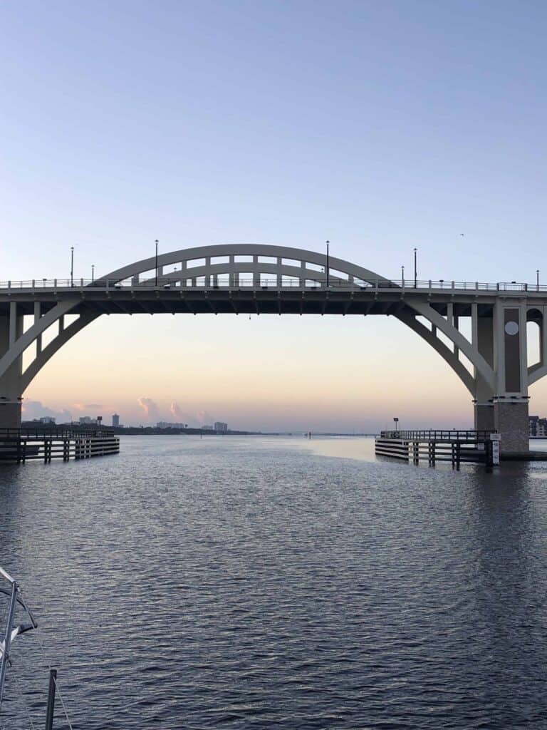
And, to make matters more confusing, most of the bridges along this stretch measure the “minimum clearance” under the bridge. This is the clearance approximately 5 feet inward from the bridge fenders. Most bridges have an arch to them, so this is the clearance where the bridge’s arch near the support has less clearance than at the center. This doesn’t tell us the maximum clearance at the bridge’s center. Regardless, it is very daunting to come up to a bridge and see a bridge clearance sign read 62.5 feet of minimum clearance with a 63-foot high mast (with all that stuff on top of it that I keep mentioning!).

The Tides Are Doing What?!?
Along this section of Florida’s coast, the tide ranges significantly from over 4 feet in St. Augustine, to no real tidal influence in Titusville, and varying tidal ranges in between. One of my go-to weather sites for tracking tides is NOAA Tides and Currents, where I am getting this information from. However, as I mentioned earlier, these are only predictions, and there are no stations in this stretch of Florida’s coast that provides actual observed water levels (that we could find anyway).

Another good source of tide predictions along the Atlantic ICW are the tide gauges within Aqua Maps. Many, but not all, of the bridges along this stretch of the ICW have tide gauges at the bridges on Aqua Maps.
The tidal gauges are helpful, but they are only predictions of what the water levels are. They do not adjust for weather influences such as wind and rain. This makes it challenging when trying to determine what the actual bridge clearances are when water levels due to wind and rain are running higher than predicted water levels.
There are nine fixed bridges with a design of 65-foot clearance at mean higher high water (MHHW), spread out across 66.4 nautical miles between St. Augustine and Titusville. Add in the varying tidal ranges and it was a fun challenge to time up passing under each of these bridges with enough clearance for our 63-foot mast to pass under. It reminded me of math class in grade school trying to figure out the time the two trains would pass each other at specific locations!
St. Augustine To Titusville In 3 Days
After much studying and planning of the Intracoastal Waterway maps (charts), we decided to break up our trip from St. Augustine to Titusville into 3 days.
Note:
Mile Markers are listed in statute miles while miles traveled are documented in nautical miles. One nautical mile is equivalent to 1.1508 statute, or land-measured, miles.
Day 1
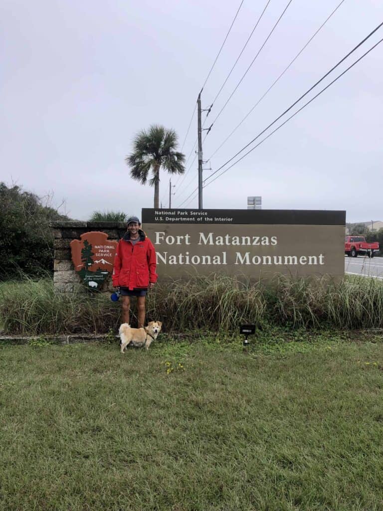
The first day we traveled 13.2 nm from St. Augustine to an anchorage at Fort Matanzas. Right at the start of this day, we passed under our first and only 65-foot bridge of the day. We left at first light to pass under the bridge as close to low tide as possible.

While the strong 20+ knot northerly winds and rain were predicted to let up today, the winds and rain and other ideas, and by the time we dropped anchor at Fort Matanzas, it was in a sideways downpour!
Bridges:
SR-312 Bridges
- Mile Marker: 780.1
- Fixed 65-foot bridge
- Used NOAA St. Augustine Beach, FL Tide Station (Station ID 8720587)
Crescent Beach SR-206 Bridge
- Mile Marker: 788.6
- Bascule bridge that opens on signal
Fort Matanzas G8 1A Anchorage
- Latitude: 29° 42’ 58.74” N, Longitude: 81° 14’ 18.71” W
- Holding: Good holding in sand with strong current
- Wind Protection: Good wind protection, but open waters Northwest and Southeast
- Depth: 10 feet
- Pet Friendly: Yes, pulled dinghy up to small beach northwest of Fort Matanzas Ferry dock on north side of inlet. Small beach leads to the parking lot for the National Park Service Visitor’s Center.
- Groceries: No
- Restaurants: No
Day 2
The second day we traveled 32.8 nm from the Fort Matanzas anchorage to Daytona. This day was a bit tricky for our 63-foot mast because we had to pass through three fixed, 65-foot clearance bridges spanning 21.8 miles. We left again just after first light, and made it through the first bridge with no issues. We did ping the top of our antenna on the first steel beam on the second 65-foot bridge (that really starts to get your attention!), then passed through the third 65-foot bridge again with no issues.
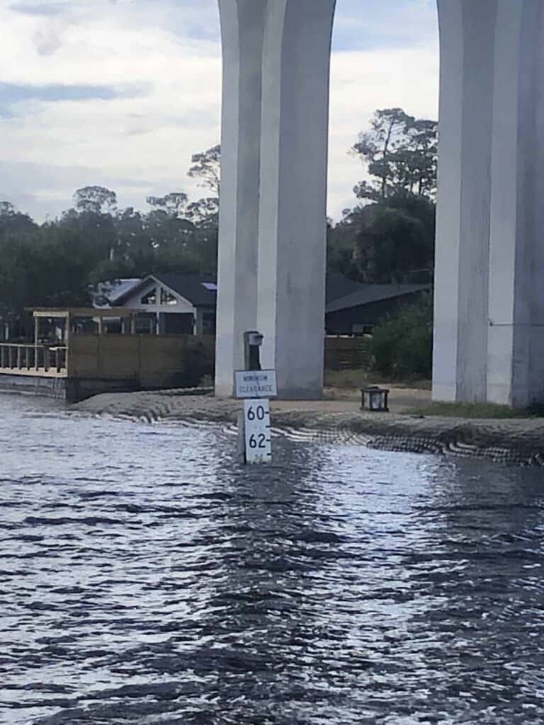
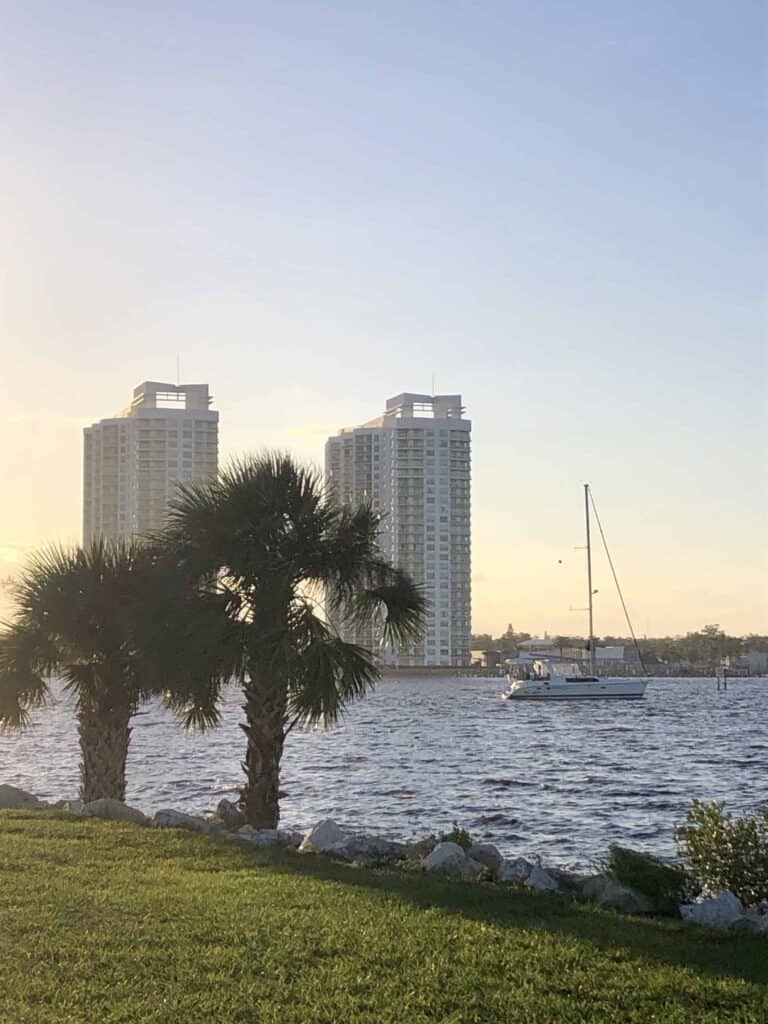
We were eager to keep going and pass through the pack of 65-foot bridges in Daytona, however, by the time we got there, the water levels were too high for us to get under. So, we dropped anchor just north of the bridges in Daytona.
Bridges
Hammock Dunes Bridge
- Mile Marker: 803.1
- Fixed 65-foot bridge
- Used NOAA Bings Landing, Matanzas River, FL Tide Station (Station ID 8720757)
SR-100 Bridge
- Mile Marker: 810.6
- Fixed 65-foot bridge
- Used NOAA Smith Creek, Flagler Beach, FL Tide Station (Station ID 8720833)
L.B. Knox Bridge
- Mile Marker: 816.1
- Bascule bridge that opens on signal
SR-40 / Ormond Beach Bridge
- Mile Marker: 824.9
- Fixed 65-foot bridge
- Used NOAA Ormond Beach, Halifax River, FL Tide Station (Station ID 8720954)
Anchorage:
Daytona – Seabreeze Anchorage (North)
- Latitude: 29° 13’ 58.74” N, Longitude: 81° 01’ 18.78” W
- Holding: Good holding in sandy mud
- Wind Protection: Protected from all directions but north (of course as luck would have it, we anchored in a fairly strong north wind that day!)
- Depth: 7-10 feet
- Pet Friendly: Yes, dinghied to a small beach at a park located under the north Seabreeze bridge
- Groceries: 7-11 walking distance 0.3 miles away
- Restaurants: Yes
Day 3
The third day we traveled 43 nautical miles from Daytona Beach to Titusville. Since we were anchored just north of our first 65-foot bridge of the day, we could see the bridge clearance sign from our boat. We were relieved to see the water levels were lower that when we arrived the afternoon prior.
We left again first thing in the morning, as this was close to low tide. The first three 65-foot bridges and one bascule bridge were all right there in Daytona within 1.5 miles of each other. After this set of bridges, we passed through one more 65-foot fixed bridge and 3 bascule bridges on our way to Titusville. We were relieved to pass through all bridges with no issues.
Upon arrival at Titusville, we took a mooring ball for the first night, before coming into a slip. The balls are well marked with plenty of room between each ball. The slips are also well marked and the staff at the marina are very helpful!
Bridges
Seabreeze Bridges (2 Bridges)
- Mile Marker: 829.1
- Fixed 65-foot bridge
- Used NOAA Ormond Beach, Halifax River, FL Tide Station (Station ID 8720954)
Main Street Bridge
- Mile Marker: 829.7
- Bascule bridge that opens on signal
International Speedway Blvd Bridge
- Mile Marker: 830.1
- Fixed 65-foot bridge
- Used NOAA Ormond Beach, Halifax River, FL Tide Station (Station ID 8720954)
Memorial Bridge
- Mile Marker: 830.6
- Fixed 65-foot bridge
- Used NOAA Ormond Beach, Halifax River, FL Tide Station (Station ID 8720954)
A1A Port Orange Relief Bridge
- Mile Marker: 835.5
- Fixed 65-foot bridge
- Used NOAA Halifax River, Ponce Inlet, FL Tide Station (Station ID 8721138)
George Musson Bridge
- Mile Marker: 845
- Bascule bridge that opens on the hour and half hour (We got a bit worried here because the bridge tender informed us they had some maintenance issues when we arrived about 15 minutes before the next bridge opening, but they corrected whatever problems they had and opened it on time to our great relief!)
Harris Saxon (South Causeway) Bridge
- Mile Marker: 846.5
- Fixed 65-foot bridge
- Used NOAA New Smyrna Beach, FL Tide Station (Station ID 8721164)
Allenhurst Haulover Canal Bridge
- Mile Marker: 869.2
- Bascule Bridge that opens on signal (was in open position when we passed through)
NASA (Jay-Jay) Railroad Bridge
- Mile Marker: 876.6
- Bascule Bridge – normally open (was in open position when we passed through)
Titusville Municipal Marina and Mooring Ball
- Latitude: 28° 37’ 18.42” N, Longitude: 80° 48’ 30.83”W
- Cost: Mooring Ball: $20/night; Slip: $2.00/ft/night or $7.00/ft/week
- Slips: Fixed docks
- Power: 30 amp: $5.00/day or $30/week; 50 amp: $9.00/day or $50/week
- Water: Free
- Laundry: Yes, $1.50 washer and $0.75 dryer. Three machines each
- Bathrooms/Showers: Yes, newly renovated – clean and nice
- Pet Friendly: Yes, dog park right next door to marina
- Groceries: Sav-A-Lot within walking distance
- Restaurants: Yes, a few within walking distance
Would We Do It Again?
That is a good question! I’m inclined to say no, we wouldn’t. While the scenery was beautiful – we saw a flock of pink flamingos flying, a few manatees, and tons of dolphins on this trip, it was very stressful with the higher-than-normal water levels.
Ideally, we would sit and wait out the weather until the conditions were good to sail on the outside in the Atlantic. Or at the very least, wait for the water levels to get closer to normal conditions.
What has your experience been sailing this part of the Florida ICW? Are you aware of actual observed water level stations for this area? I would love to hear from you and hear about your experiences sailing the ICW.
Live your dream,

